Catalogue PIGMA
/Physical Oceanography/Salinity
Type of resources
Available actions
Topics
Keywords
Contact for the resource
Provided by
Years
Formats
Representation types
Update frequencies
status
Scale
Resolution
-
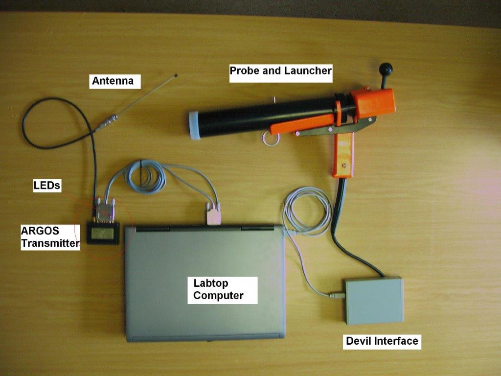
X : eXpendable; B : Bathy; T: Thermograph. Thermal profile measurement with real-time transmission
-

GOSUD aims at assembling in-situ observations of the world ocean surface collected by a variety of ships and at distributing quality controlled datasets. At present time the variables considered by GOSUD are temperature and salinity. The GOSUD data are mostly collected using thermosalinographs (TSG) installed on research vessels, on commercial ships and in some cases on sailing exploration ships. GOSUD manages both near-real time (RT and NRT) data and delayed mode (DM-reprocessed) data. The GOSUD GDAC is hosted by the Coriolis data centre (France) and a back-up (permanent archived) is performed on a daily basis by NCEIS (NOAA's National Centers for Environmental Information).
-
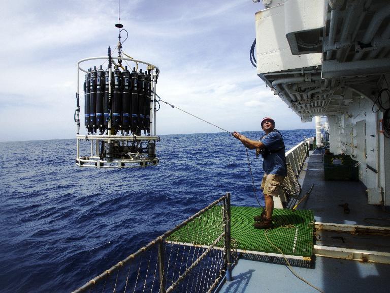
The Niskin or go-flo bottles collect water samples at pressures, temperatures and salinity which will be characterized using the CTD coupled to them. Numerous analyses are performed on the basis of these water samples: chemical (Nutrients, O2, etc.), biological (virus, bacteria, Chlorophyll A, etc.).
-
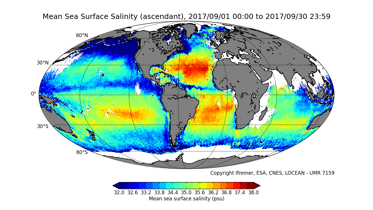
This product contains average 10 days & monthly salinity field based on L2P products, mixing ascending and descending orbits. ** This product is no longer available, see below **
-
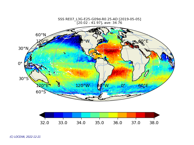
This product contains daily salinity fields from a 9 days temporal gaussian average, corrected from land-sea contamination and latitudinal bias, based on L2Q products, mixing ascending and descending orbits.
-
The main purpose of the CYBER database, which supports projects selected by the Committee LEFE-CYBER, is to collect, store and disseminate data and scientific information (metadata).
-
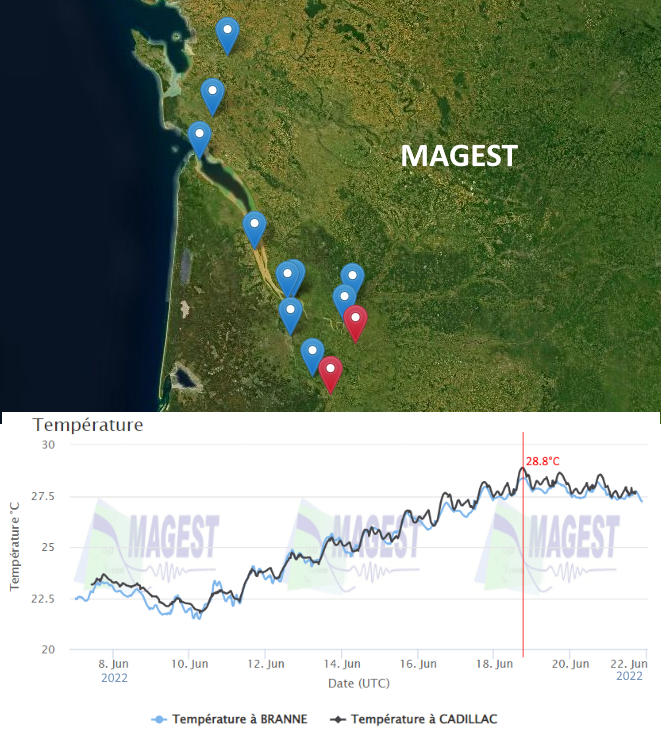
The MAGEST observation network aims to continuously monitor the physico-chemical quality of the waters of the estuaries of Northern Aquitaine. In 2023, this regional network is composed of 12 stations.
-
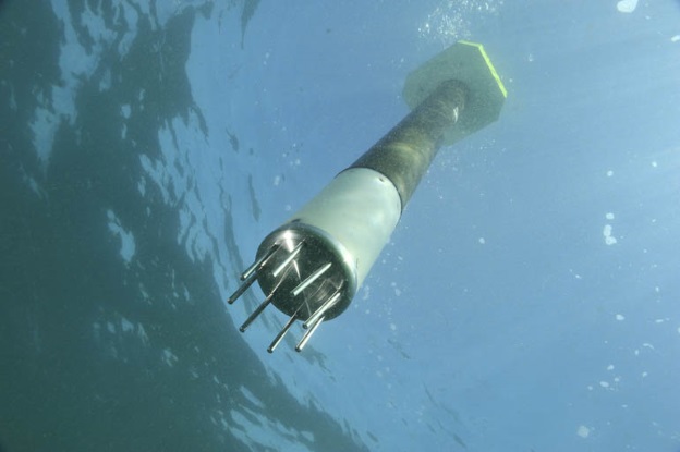
ARVOR-C is a subsurface profiling float designed to operate in coastal environments and to perform oceanographic measurements like a moored installation. Its design has been improved to reduce its drift thanks to a seabed claw and anti-drift claws, an optimized profile speed (~ 25 cm / s) and a short-period data transmission. It is able to process more than 300 profiles and real-time data transmission via Iridium satellite system.
-
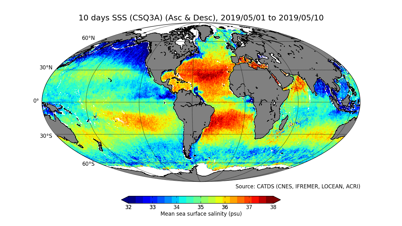
This product contains average 10 days & monthly salinity field corrected from land-sea contamination and latitudinal bias, based on L2Q products, mixing ascending and descending orbits.
-